
use +/- or mouse scrollwheel for magnification. click here for full-sized image.
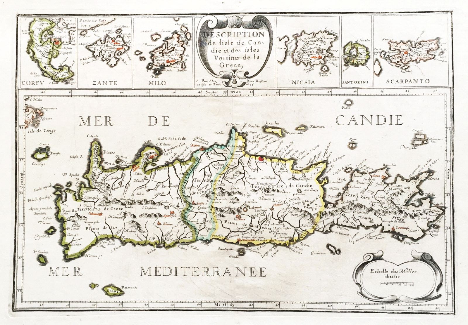
Description de l'isle de Candie et des isles Voisine de la Grece
This item has been sold. Please check our homepage for currently available maps.
A superb map of the island of Crete divided into territories, with many place names and topographical details. Along the top, on either side of the elegant scroll cartouche are inset maps of Corfu, Zante, Milo, Nicosia, Santorini, and Scarpanto. Item Number: RS1033
Cartographer: Boisseau
Place & Date: Paris / 1645
Size: 18 1/2" x 12 3/4"
Condition: outline color; two small wormholes in upper margin; left and right corners of wide bottom margin torn off
Price: SOLD