
use +/- or mouse scrollwheel for magnification. click here for full-sized image.
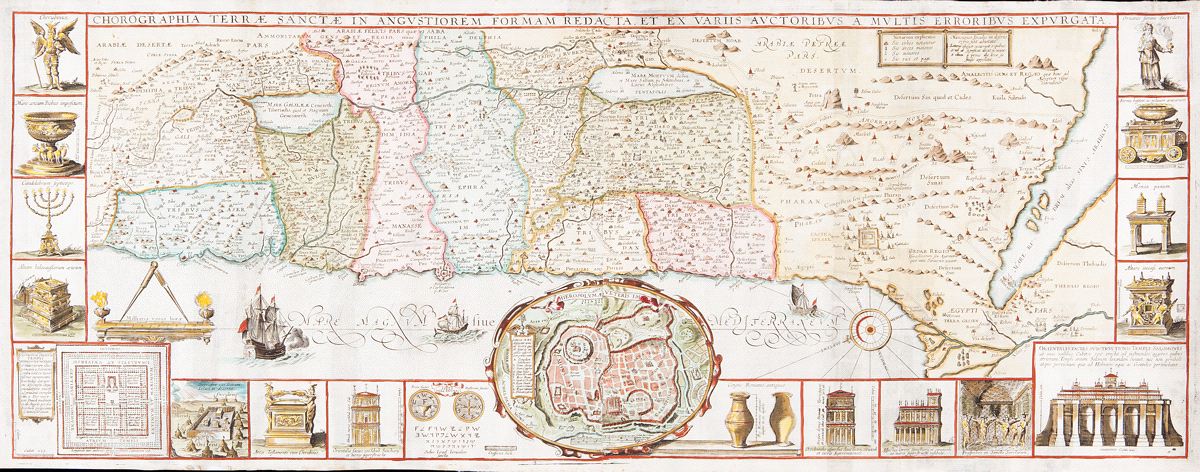
Chorographia Terrae Sanctae in Angustiorem formam Redacta et ex Variis Auctoribus a Multis Erroribus Expurgata
This item has been sold. Please check our homepage for currently available maps.
A large, marvelously detailed and beautifully colored map of the Holy Land surrounded by 18 panels depicting temple features and instruments including the seven-branched candlestick, the Arc of the Covenant, the altar of sacrifices, the Holy of Holies, and a plan and elevations of the Temple. At the center of the sheet, below the map itself, is a plan of ancient Jerusalem with a letter key to the principal monuments. A fascinating Holy Land map. Item Number: MD2470
Cartographer: Tirinus
Place & Date: Antwerp / 1632 (or later)
Size: 33 1/2" x 12 3/4"
Condition: fully colored; some staining along lower margin; folds reinforced.
Price: SOLD