
use +/- or mouse scrollwheel for magnification. click here for full-sized image.
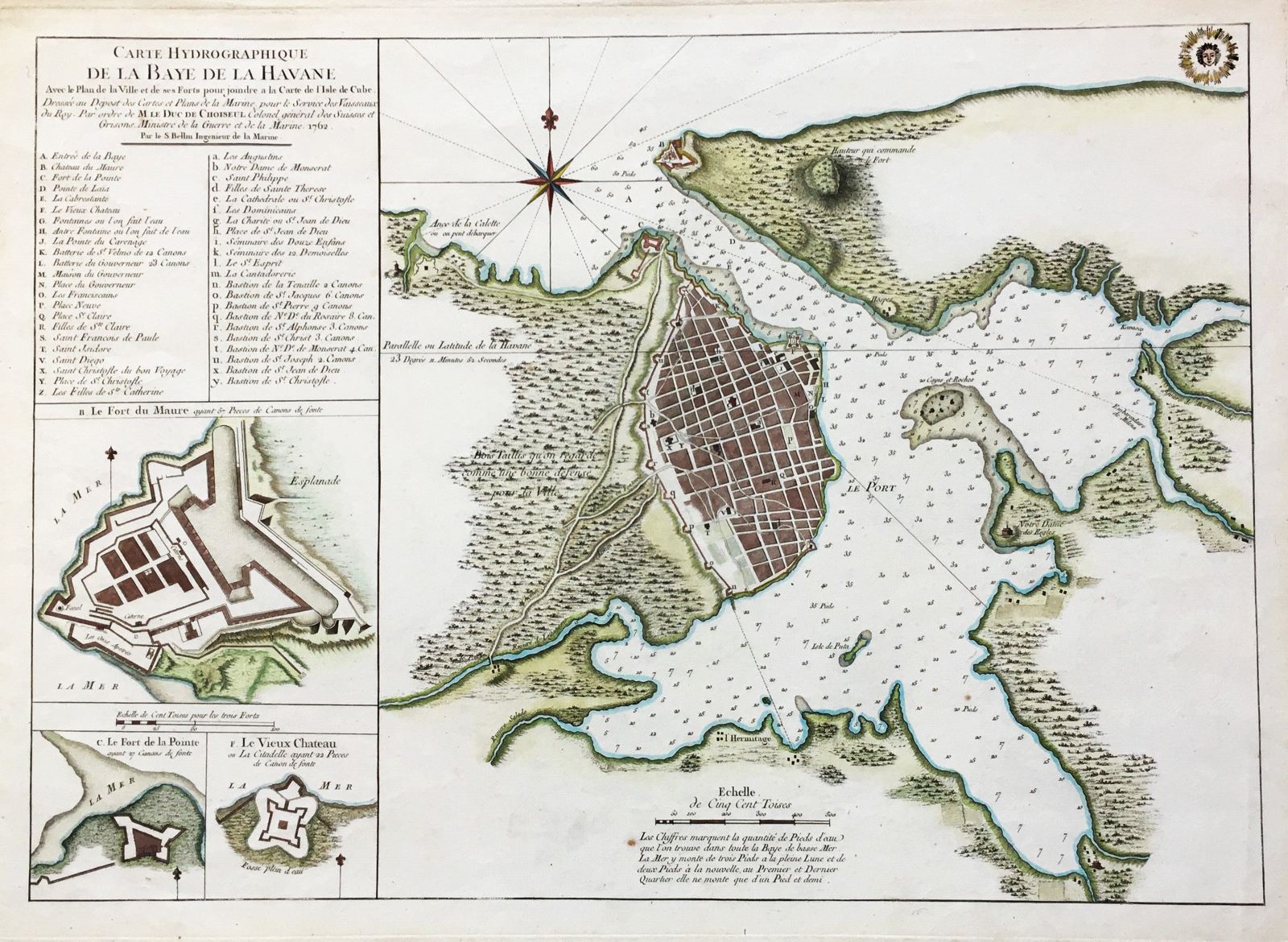
Carte Hydrographique de la Baye de la Havane.
This item has been sold. Please check our homepage for currently available maps.
From Bellin's Hydrographie Francaise, this superbly detailed plan of the walled city of Havana and its harbor features inset plans of three forts (La Punta, El Morro, and La Real Fuerza) as well as a key to 45 major landmarks in the city. A beautifully colored and preserved exemplar. Item Number: K863
Cartographer: Bellin / Depot de la Marine
Place & Date: Paris / 1762/1772
Size: 22 1/4" x 16 1/4"
Condition: wash color; overall age toning and a few spots
Price: SOLD