
use +/- or mouse scrollwheel for magnification. click here for full-sized image.
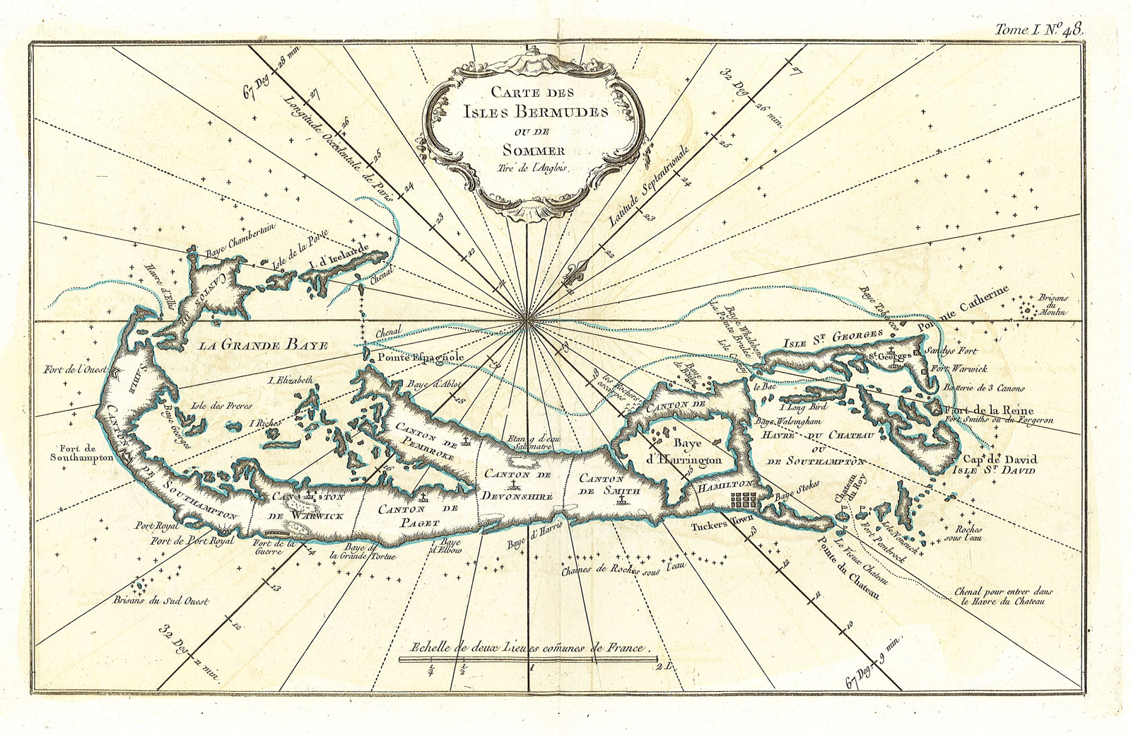
Carte des Isles Bermudes ou de Sommer
This item has been sold. Please check our homepage for currently available maps.
The uncommon and beautifully detailed map of Bermuda divided into parishes, from Bellin's Petit Atlas Maritime. Includes good navigational detail—harbors, bays, shoals, and rocks around shorelines—and a lovely rococo title cartouche. Item Number: GG2544
Cartographer: Bellin
Place & Date: Paris / 1764
Size: 12 3/4" x 8"
Condition: original outline color; light overall age toning; light overprinting
Price: SOLD