
use +/- or mouse scrollwheel for magnification. click here for full-sized image.
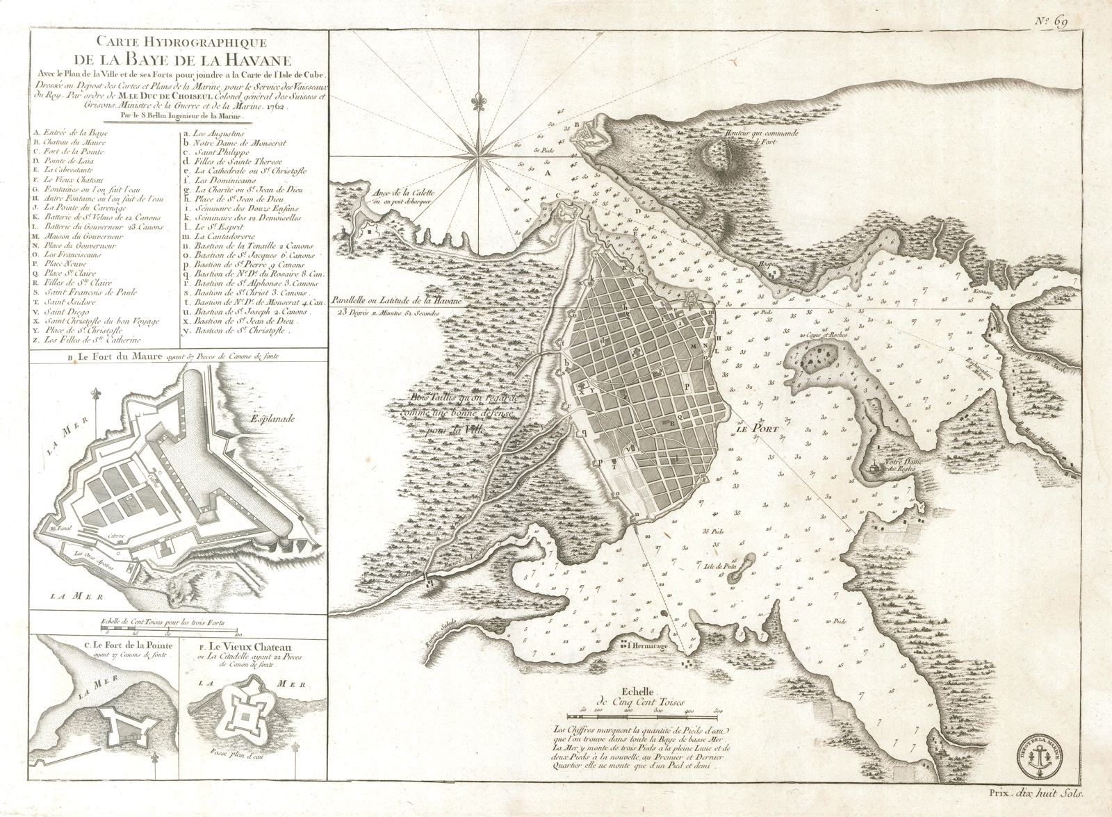
Carte Hydrographique de la Baye de la Havane.
This item has been sold. Please check our homepage for currently available maps.
From Bellin's Hydrographie Francaise, this superbly detailed plan of the walled city of Havana and its harbor features inset plans of three forts (La Punta, El Morro, and La Real Fuerza) as well as a key to 45 major landmarks in the city. Item Number: GG2539
Cartographer: Bellin / Depot de la Marine
Place & Date: Paris / 1762/1772
Size: 22 1/4" x 16 1/4"
Condition: b&w; some nicks, splits and fraying along edges of wide margins
Price: SOLD