
use +/- or mouse scrollwheel for magnification. click here for full-sized image.
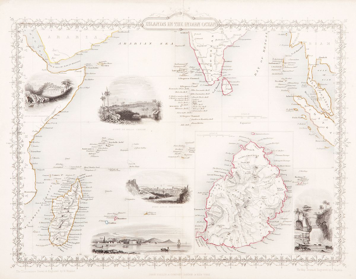
Islands in the Indian Ocean
This item has been sold. Please check our homepage for currently available maps.
The superb Indian Ocean islands map from Tallis' Illustrated Atlas extending from the east coast of Africa and Madagascar to southern Indian, Ceylon, and Southeast Asia. Within the main map are a large inset map of Mauritius and four vignettes (Point de Galle, Ceylon; Port Louis, Mauritius; Prince of Wales Island; and Fall of the River Roche, Isle of Bourbon/Reunion). The whole is surrounded by a beautifully decorative colored border. Item Number: GG2495
Cartographer: Tallis
Place & Date: London/New York / 1851
Size: 13 1/4" x 10 1/2"
Condition: color; overall age toning; some nicks and creasing along outer edges of margins; split in centerfold in upper and lower margins
Price: SOLD