
use +/- or mouse scrollwheel for magnification. click here for full-sized image.
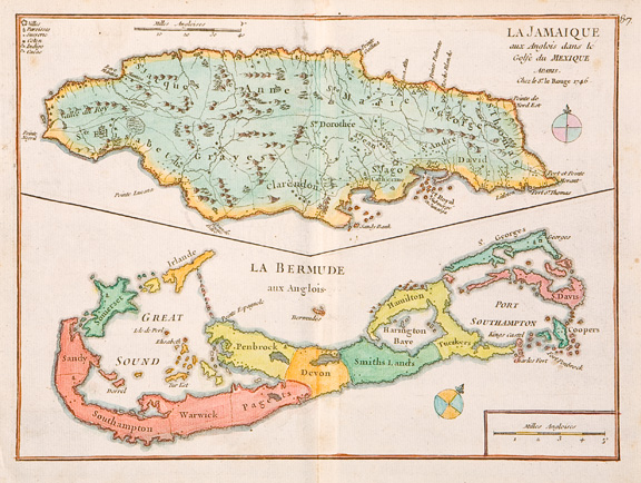
La Jamaique aux Anglois dans le Golfe du Mexique a Paris [with on the same sheet] La Bermude aux Anglois
This item has been sold. Please check our homepage for currently available maps.
Two colorful, early maps of British possessions in the Caribbean and the Atlantic on one sheet from le Rouge's Introduction a La Geographie. The upper map depicts Jamaica divided into parishes, with a symbol key to towns, parishes and sugar, cotton, indigo and cacao plantations. The lower map shows Bermuda, also divided into parishes, and with a second, tiny Bermuda ("Bermudos") located offshore, between the title and the main map. This is a holdover from John Speed's Bermuda map of 1627, on which le Rouge based his map. Item Number: GG2094
Cartographer: le Rouge
Place & Date: Paris / 1746
Size: 10 1/2" x 7 3/4" (both maps)
Condition: full wash color; light overall age toning; some spotting, mostly in the magins
Price: SOLD