
use +/- or mouse scrollwheel for magnification. click here for full-sized image.
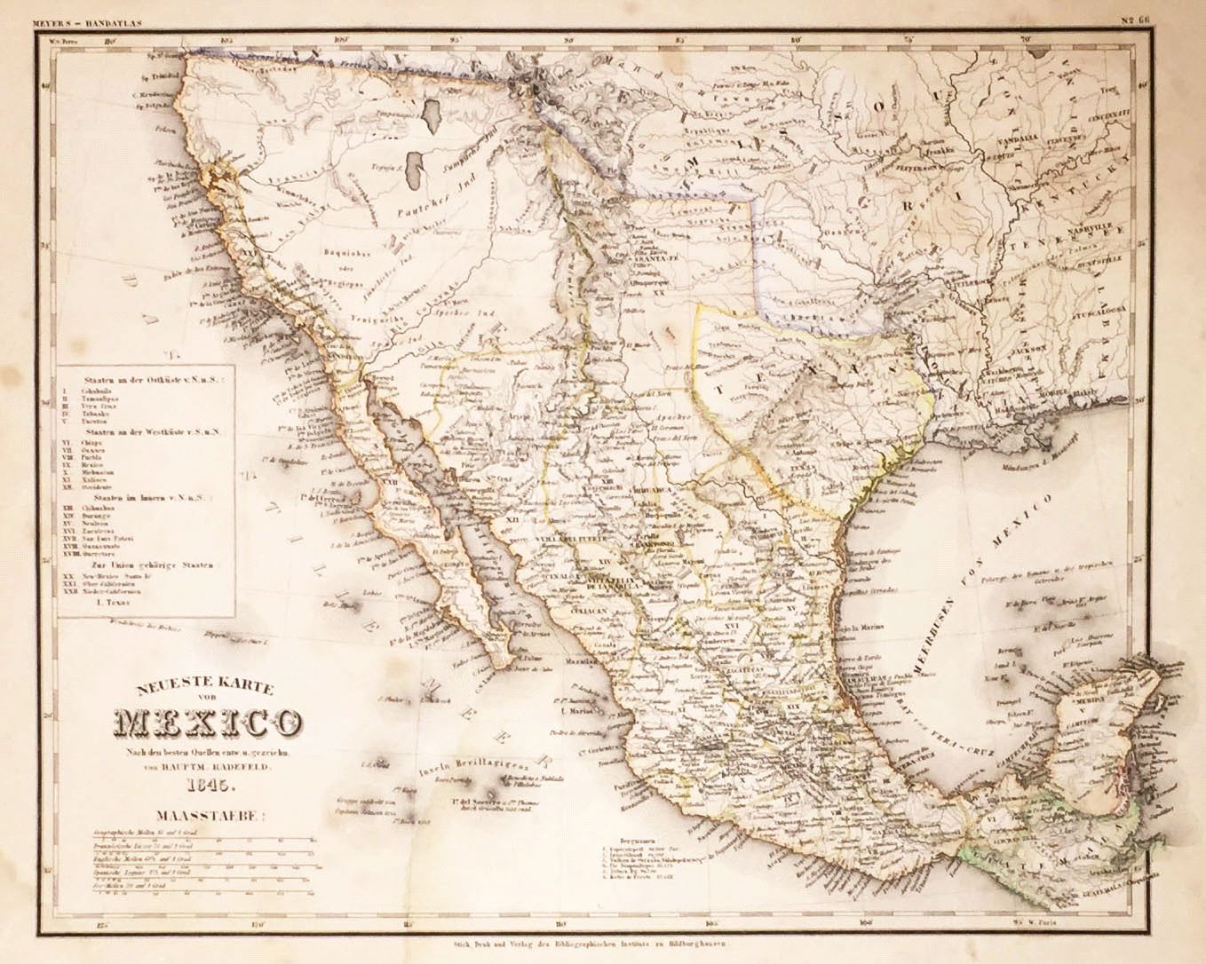
Neueste Karte von Mexico
This item has been sold. Please check our homepage for currently available maps.
A fascinating and superbly detailed map of Mexico at its fullest extent just prior to the Mexican American War; from the 1845 edition of Meyer's Hand-Atlas. Before the loss of its northern half, Mexico is bordered by an independent Texas (whose southern border is still the Nueces River) and the Ozark, Osage, Mandanen and Oregon territories of the United States. An important record of a critical moment in U.S. and Mexican history. Item Number: G682
Cartographer: Bibliographischen Instituts.
Place & Date: Hildburghausen / 1845
Size: 14 1/8" x 11 3/8"
Condition: original outline color; overall age toning; water stains on lower left corner of margin; some spotting and repaired marginal nicks
Price: SOLD