
use +/- or mouse scrollwheel for magnification. click here for full-sized image.
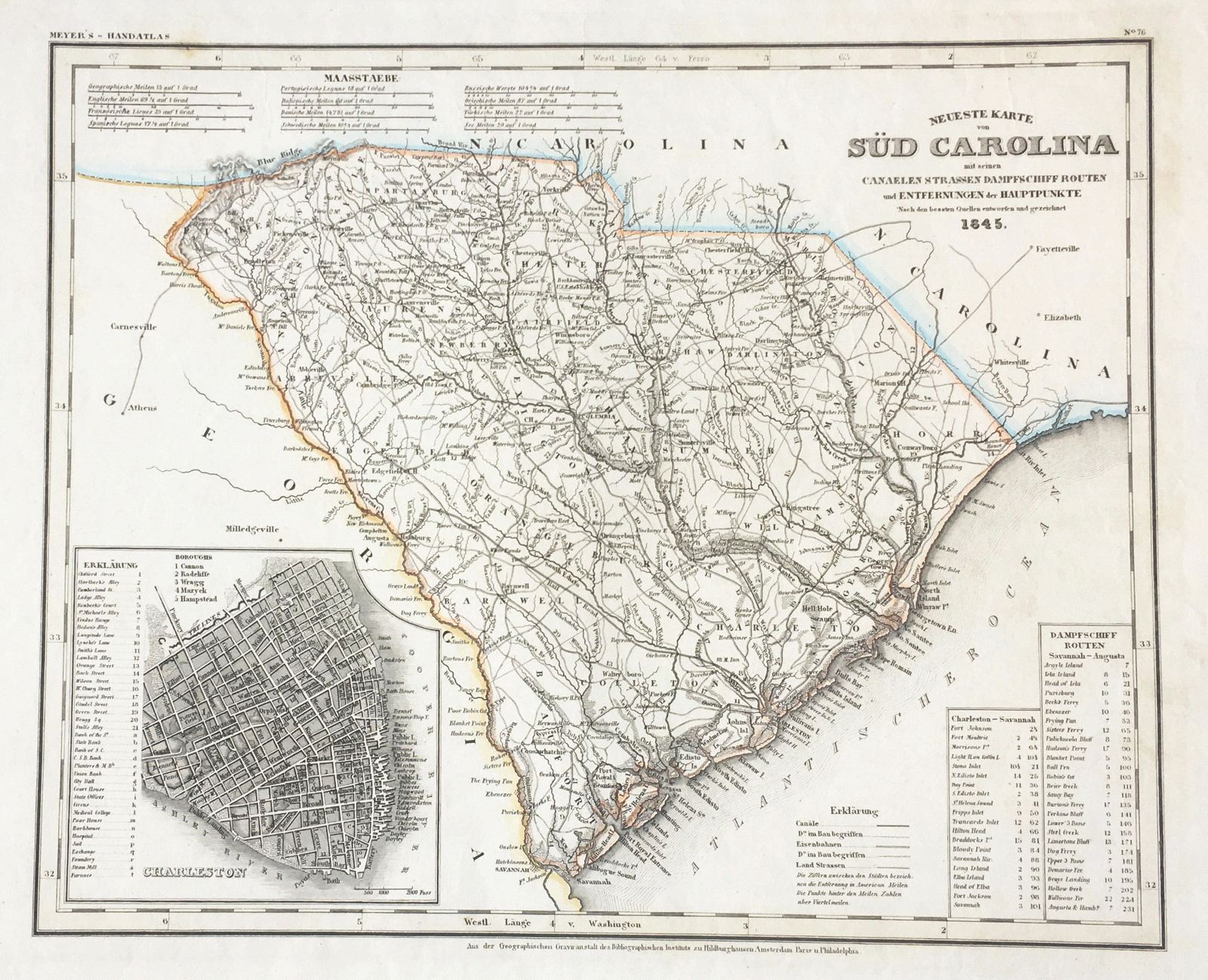
Neueste Karte von Sud Carolina
This item has been sold. Please check our homepage for currently available maps.
The beautifully detailed and colored map of South Carolina "with its canals, streets, steamship routes and distances between main towns" from the 1845 edition of Meyer's Hand-Atlas. Includes a key to canals, railroads, and main roads, as well as steamship routes between Charleston and Savannah and Savannah and Augusta. Item Number: G665
Cartographer: Bibliographischen Instituts.
Place & Date: Hildburghausen / 1845
Size: 11 3/4" x 14 1/2"
Condition: original outline color; minor spotting in margins a few nicks along outer edges of left margin
Price: SOLD