
use +/- or mouse scrollwheel for magnification. click here for full-sized image.
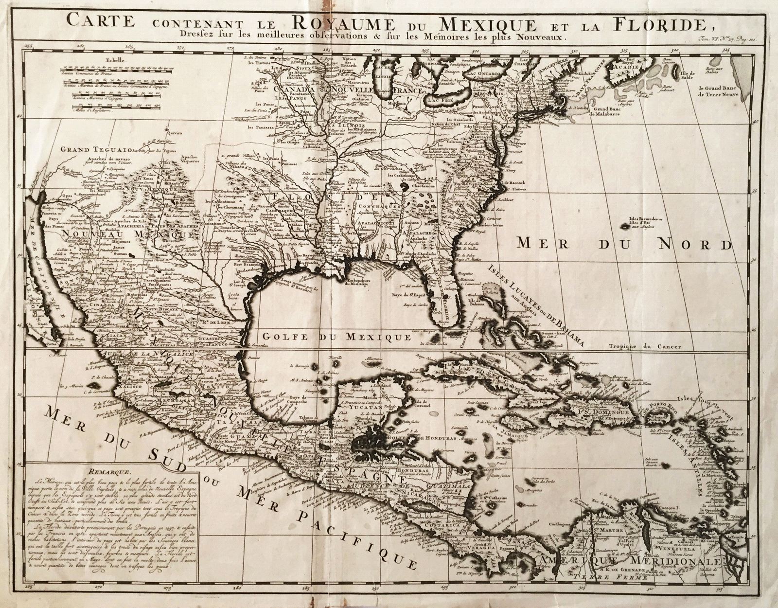
Carte contenant le Royaume du Mexique et la Floride
This item has been sold. Please check our homepage for currently available maps.
Chatelain's superb map of North America and the West Indies, from Newfoundland and the Great Lakes to Northern South America. A bright, strong impression from Chatelain's Atlas Historique. Item Number: G445
Cartographer: Chatelain
Place & Date: Amsterdam / 1719
Size: 20 1/2" x 16"
Condition: b&w; margins frayed; overall age toning; stain on upper part of centerfold, affecting one letter of title
Price: SOLD