
use +/- or mouse scrollwheel for magnification. click here for full-sized image.
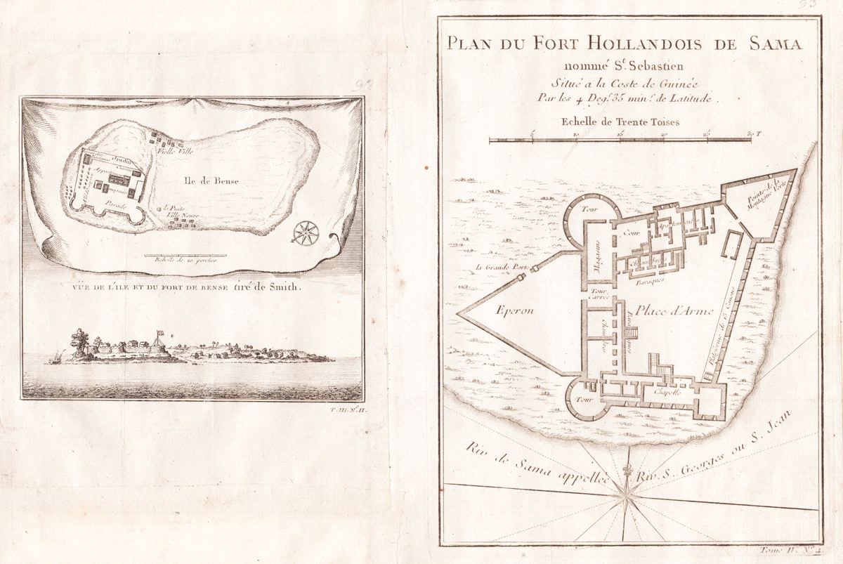
1) Vue de l'Ile et du Fort de Bense 2) Plan du Fort Hollandois de Sama nomme S. Sebastien Situe a la Coste de Guinee
This item has been sold. Please check our homepage for currently available maps.
A composite page from the atlas volume of Prévost d'Exiles' influential collection of travel narratives, Histoire Générale des Voyages, featuring, on the left, a view of Bunce Island in the Sierra Leone River and a plan of the Island's fort. On the right is a plan of the Dutch fort of San Sebastian in Shama on the Gold Coast of present-day Ghana. Both Bunce Island and Fort San Sebastian were departure points for multitudes of enslaved Africans bound for North America. Item Number: G2973
Cartographer: Bellin/Prevost d'Exiles
Place & Date: Paris / 1755
Size: 1) 5 7/8" x 8 1/4; 2) 7" x 5 1/2"
Condition: b&w; light overall age toning
Price: SOLD