
use +/- or mouse scrollwheel for magnification. click here for full-sized image.
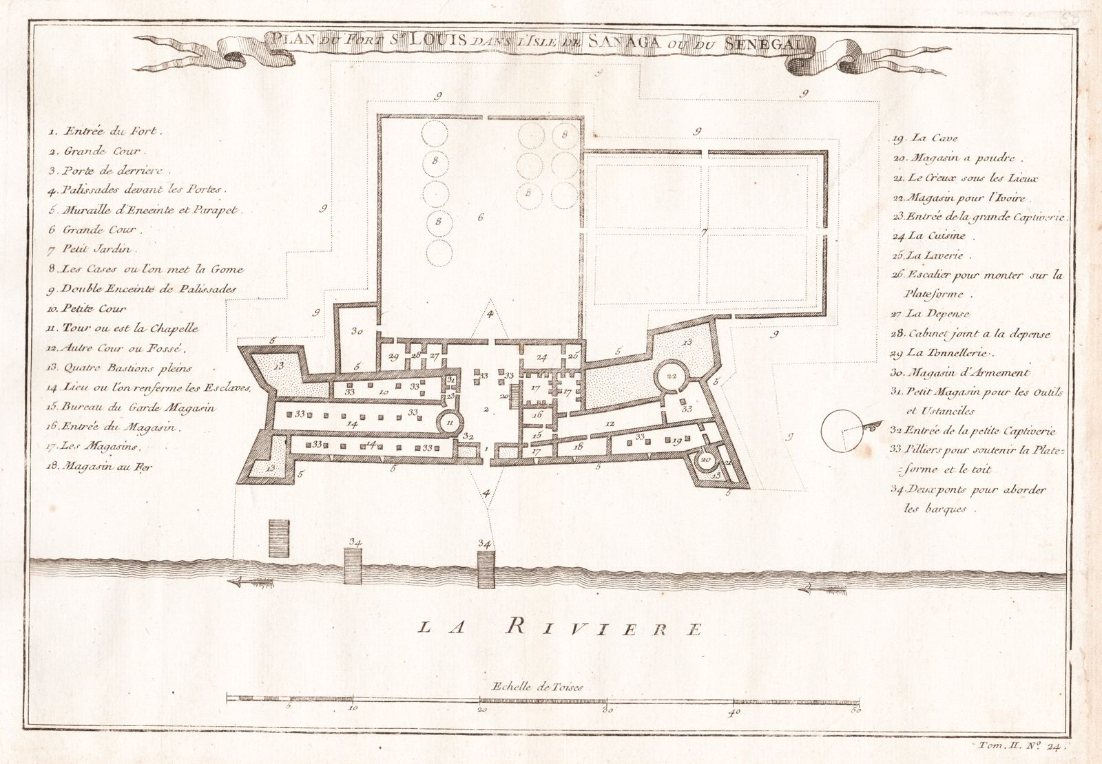
Plan du Fort St Louis dans l'isle de Sanaga ou du Senegal
This item has been sold. Please check our homepage for currently available maps.
The highly detailed plan, with a 34-point numeric key to sites, of the French colonial fort on the island of St. Louis in the Senegal River in West Africa, from the atlas volume of Prévost d'Exiles' landmark collection of travel narratives, Histoire Générale des Voyages. Item Number: G2970
Cartographer: Bellin/Prevost d'Exiles
Place & Date: Paris / 1755
Size: 11 7/8" x 8 1/8"
Condition: b&w; light overall age toning; minor spotting mostly in the margins
Price: SOLD