
use +/- or mouse scrollwheel for magnification. click here for full-sized image.
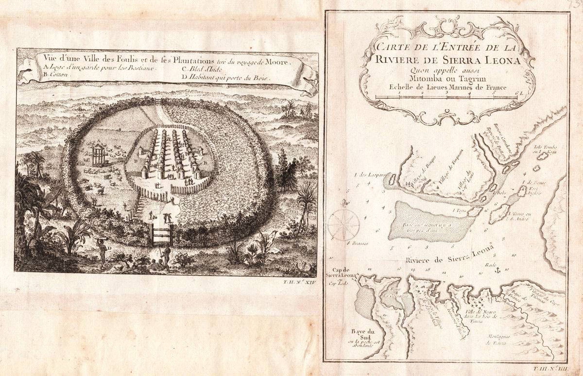
1. Vüe d'une ville des Foulis et de ses plantations, tirée du voyage de Moore 2. Carte de l'Entree de la Riviere de Sierra Leona Quon appelle ausi Mitojba our Tagrim
This item has been sold. Please check our homepage for currently available maps.
A fascinating bird's-eye view of a Fula town and its surrounding cotton plantations in what is now Senegal on the same composite page as a highly detailed chart of the mouth of the Sierra Leone River, from the atlas volume of Prévost d'Exiles' influential collection of travel narratives, Histoire Générale des Voyages. Item Number: G2954
Cartographer: Bellin/Prevost d'Exiles
Place & Date: Paris / 1755
Size: 1) 7" x 5 1/4; 2. 5 5/8" x 8 1/8"
Condition: b&w; light overall age toning, minor spotting
Price: SOLD