
use +/- or mouse scrollwheel for magnification. click here for full-sized image.
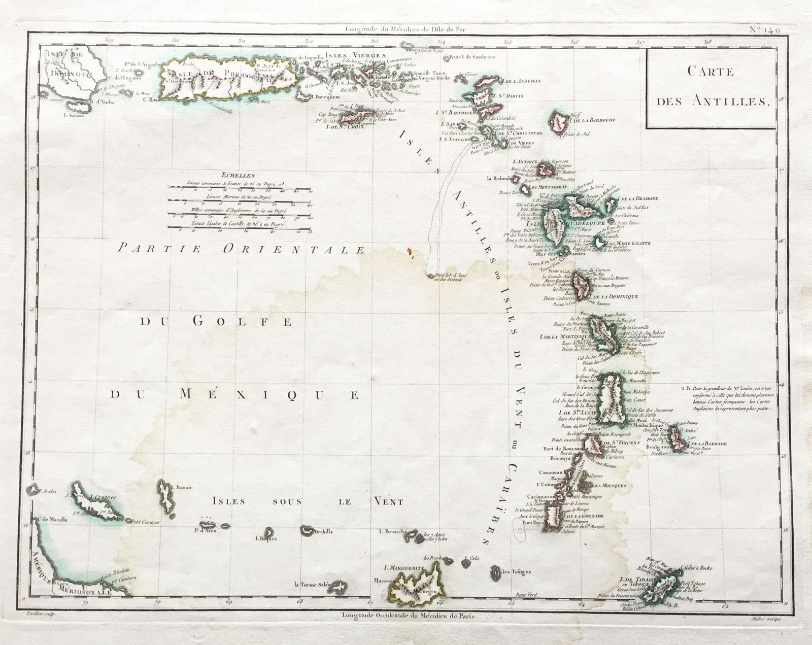
Carte des Antilles
This item has been sold. Please check our homepage for currently available maps.
A beautifully designed and detailed map of the Lesser Antilles extending from the eastern tip of Hispaniola to Curacao, from Chanlaire & Mentelle's Atlas Universel de Geographie Physique et Politique Item Number: G2922
Cartographer: Chanlaire & Mentelle/Tardieu
Place & Date: Paris / 1797
Size: 16 1/2" x 13"
Condition: outline and wash color; large water stains in center of map and right margin; small holes and repaired tears in wide margins
Price: SOLD