
use +/- or mouse scrollwheel for magnification. click here for full-sized image.
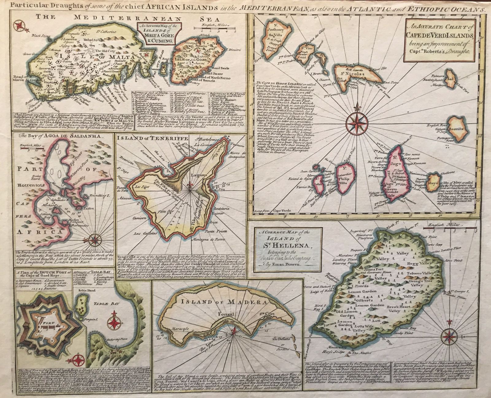
Particular Draughts of some of the chief African Islands in the Mediterranean, as also in the Atlantic and Ethiopic Oceans.
This item has been sold. Please check our homepage for currently available maps.
Bowen's fascinating composite map of the islands surrounding Africa in the Atlantic, the Mediterranean, and the Indian Ocean. Each of the eight maps on the sheet (Malta and Gozo, the Cape Verde Islands, the Bay of Agoa de Saldanha, Tennerife, St. Helena, Madeira, Table Bay, and the Dutch Fort at the Cape of Good Hope) includes geographical and historical notes. The Maltese Islands maps includes a key to 20 sites on Malta and 9 on Gozo. Item Number: G288
Cartographer: Bowen
Place & Date: London / 1752
Size: 16 3/4" x 13 3/4"
Condition:
Price: SOLD