
use +/- or mouse scrollwheel for magnification. click here for full-sized image.
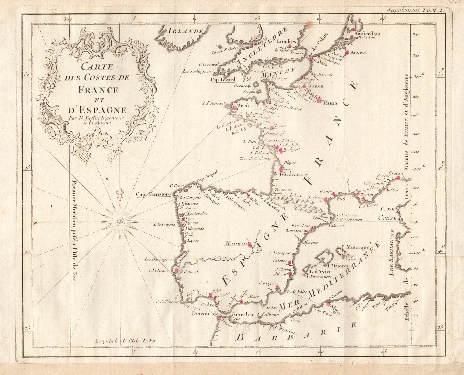
Carte des Costes de France et d'Espagne
This item has been sold. Please check our homepage for currently available maps.
Bellin's highly detailed chart of the Atlantic and Mediterranean coasts of France and Spain, with parts of the coasts of Ireland, England and northwest Africa ("Barbarie") from Prevost d'Exiles' influential collection of travel narratives, Histoire Generale des Voyages. Major cities in the featured countries are pinpointed in red. Item Number: G2879
Cartographer: Jacques Nicolas Bellin
Place & Date: Paris / 1749/1760
Size: 11" x 9"
Condition: b&w; light overall age toning; margins extended with contemporary paper to fit the size of the atlas volume
Price: SOLD