
use +/- or mouse scrollwheel for magnification. click here for full-sized image.
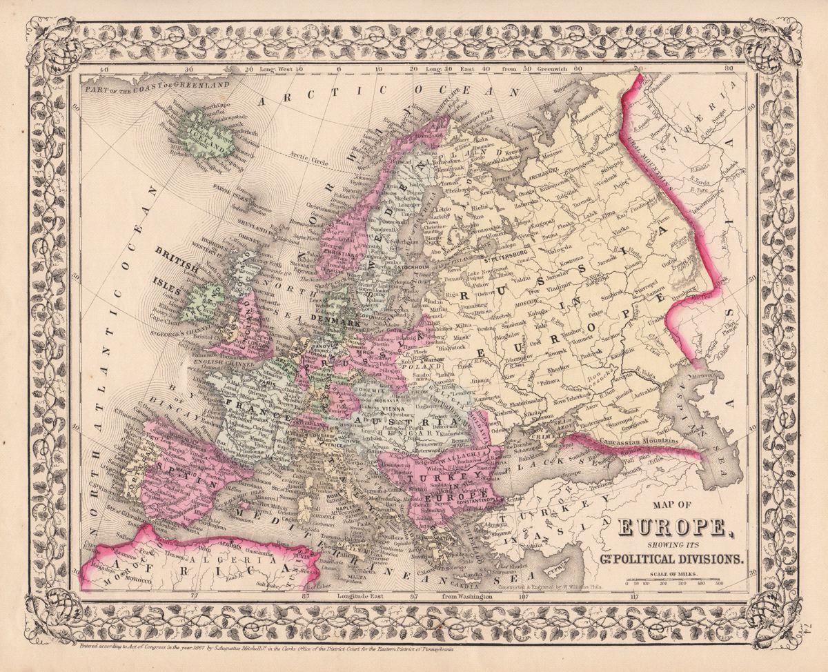
Map of Europe, showing its Gt. Political Divisions.
This item has been sold. Please check our homepage for currently available maps.
The beautifully detailed and colored map of the European continent from the 1870 edition of Mitchell's popular New General Atlas of the world. Northern Greece is still part of the Ottoman Empire ("Turkey in Europe"); Poland is divided among Prussia, Russia, and Austria; Finland is part of "Russia in Europe"; and the Veneto is still shown as part of Austria, although it had been joined to the new Kingdom of Italy in 1866. The map is framed by the decorative vine motif border typical of Mitchell maps of the mid-1860s to 1881. Item Number: G2759
Cartographer: S. A. Mitchell
Place & Date: Philadelphia / 1867/1870
Size: 13 1/4" x 10 7/8"
Condition: full color; light overall age toning
Price: SOLD