
use +/- or mouse scrollwheel for magnification. click here for full-sized image.
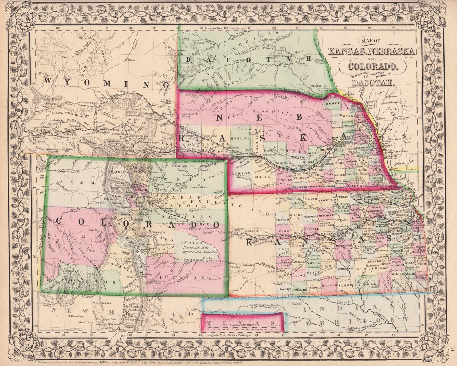
Map of Kansas, Nebraska and Colorado, Showing the Southern Portion of Dakotah.
This item has been sold. Please check our homepage for currently available maps.
The beautifully detailed and colored county map of of the states of Kansas, Nebraska, Colorado and part of what is now South Dakota, from the 1870 edition of Mitchell's popular New General Atlas of the world. Framed by the decorative vine motif border typical of Mitchell maps of the mid-1860s to 1881, the map encompasses parts of Iowa, Missouri, the Indian Territory (now Oklahoma), Texas, New Mexico, Utah and a large part of Wyoming. Item Number: G2751
Cartographer: S. A. Mitchell
Place & Date: Philadelphia / 1870
Size: 11 1/2" x 14"
Condition: full color; light overall age toning
Price: SOLD