
use +/- or mouse scrollwheel for magnification. click here for full-sized image.
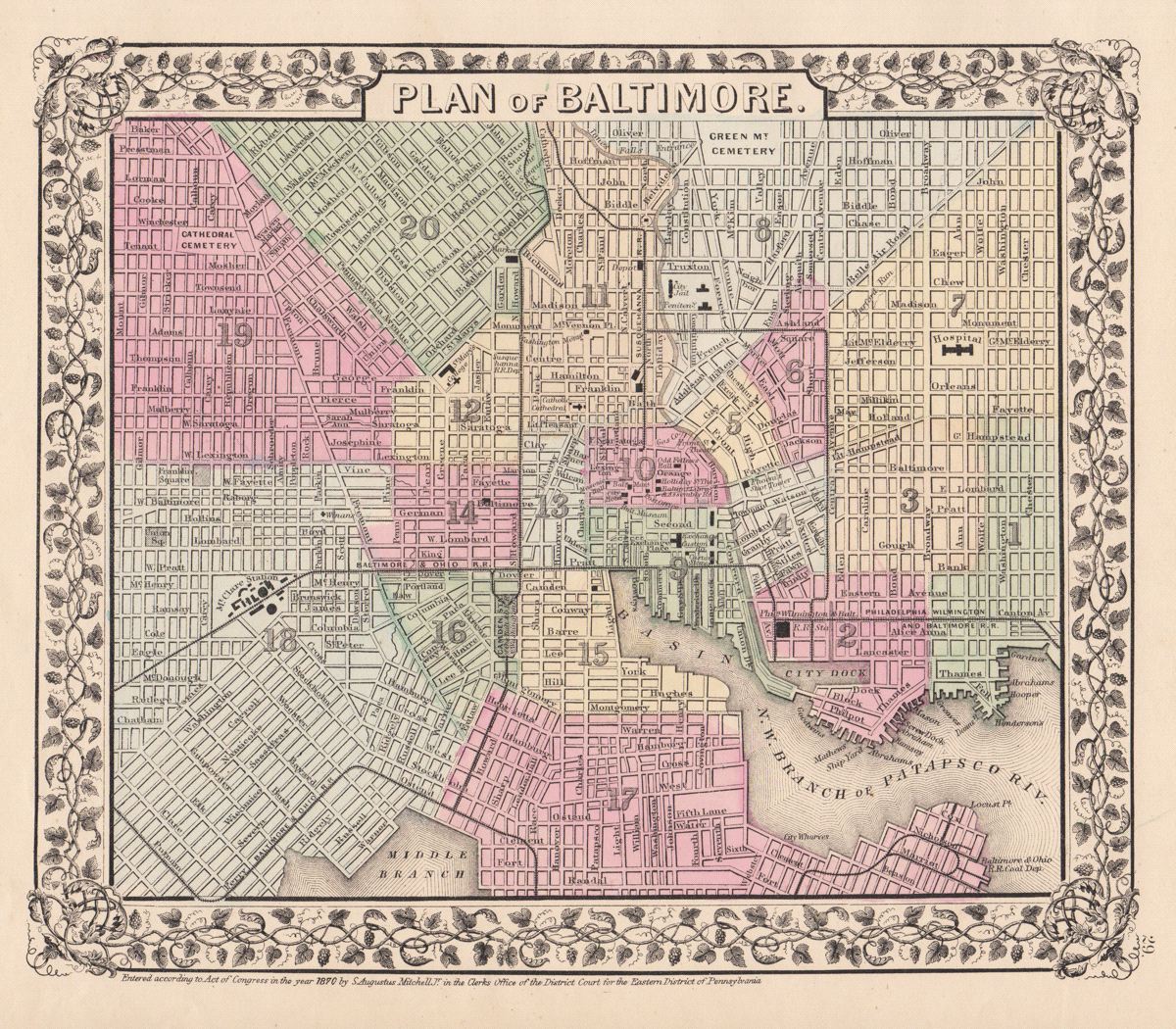
Plan of Baltimore
This item has been sold. Please check our homepage for currently available maps.
The marvelously detailed and colored street plan of Philadelphia from the 1870 edition of Mitchell's popular New General Atlas of the world. The plan is framed by the vine motif border typical of Mitchell maps of the mid-1860s to 1881. Item Number: G2734
Cartographer: S. A. Mitchell
Place & Date: Philadelphia / 1870
Size: 11" x 9 1/2"
Condition: full color; light overall age toning
Price: SOLD