
use +/- or mouse scrollwheel for magnification. click here for full-sized image.
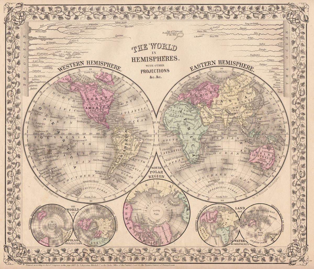
The World in Hemispheres with Other Projections
This item has been sold. Please check our homepage for currently available maps.
A fascinating collection of hemisphere maps on a single page from the 1870 edition of Mitchell's popular New General Atlas of the world. Framed by the vine motif border typical of Mitchell maps of the mid-1860s to 1881, the page features maps of the Western and Eastern Hemispheres and the North Polar Region, the World on a Polar Projection, and Land & Water Hemispheres. Wedged on top of the main hemisphere maps are graphic charts comparing the lengths of the world's major rivers. Item Number: G2722
Cartographer: S. A. Mitchell
Place & Date: Philadelphia / 1867/1870
Size: 13" x 11 1/4"
Condition: wash color; overall age toning; nicks and fraying along edge of upper margin
Price: SOLD