
use +/- or mouse scrollwheel for magnification. click here for full-sized image.
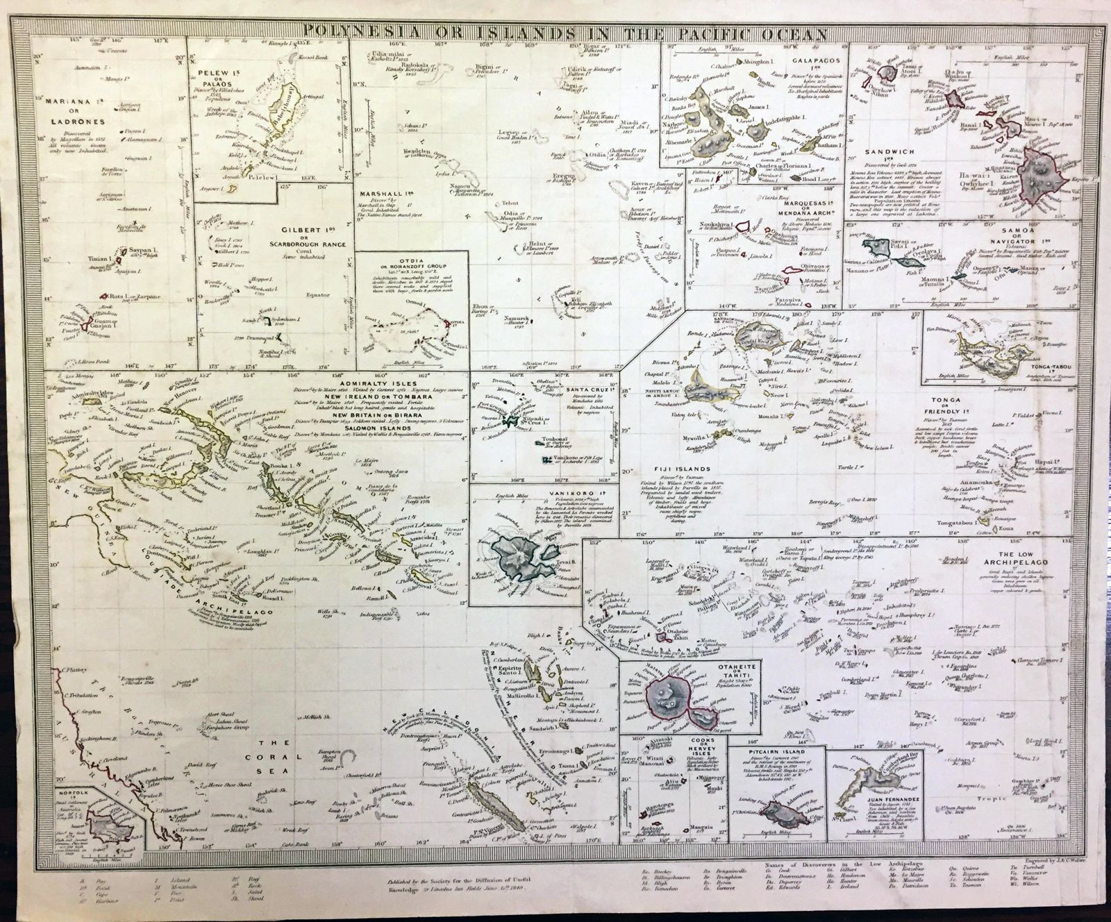
Polynesia or Islands in the Pacific
This item has been sold. Please check our homepage for currently available maps.
A fascinating sheet from the SDUK atlas, featuring 20 distinct maps or insets of Polynesian islands or island groups, with notes on their discoverers, history, and geography. The featured islands include: the Marianas, Pelew, the Gilberts, the Marshalls, Otdia, the Galapagos, the Marquesas, the Sandwich, Samoa, Tonga, Fiji and Friendly Islands, Admiralty and Salomon Islands, Norfolk, Santa Cruz, Vanikoro, the Low Archipelago, Tahiti, Cooks, PItcairn, and Juan Fernandez. Item Number: G267
Cartographer: Society for the Diffusion of Useful Knowledge
Place & Date: London / 1840
Size: 15 5/8" x 12 1/4"
Condition: outline color; overall age-toning foxing
Price: SOLD