
use +/- or mouse scrollwheel for magnification. click here for full-sized image.
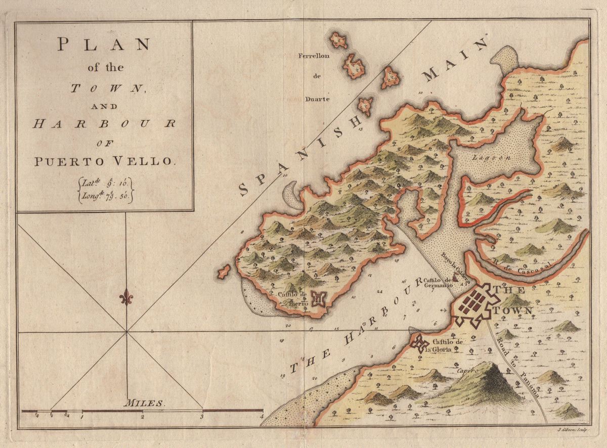
Plan of the Town, and Harbour of Puerto Vello
This item has been sold. Please check our homepage for currently available maps.
A scarce, very detailed 18th-century chart of the port and city of Portobello in Panama and its surrounding forts, from Capt. Joseph Smith Speer's West-India Atlas. Depth soundings and anchorages are noted in the harbor and the "Road to Panama" is labeled at the lower right. Item Number: G2636
Cartographer: Capt. Joseph Smith Speer
Place & Date: London / 1771
Size: 13" x 9"
Condition: wash color; wide margins; tiny holes along bottom neatline, well repaired
Price: SOLD