
use +/- or mouse scrollwheel for magnification. click here for full-sized image.
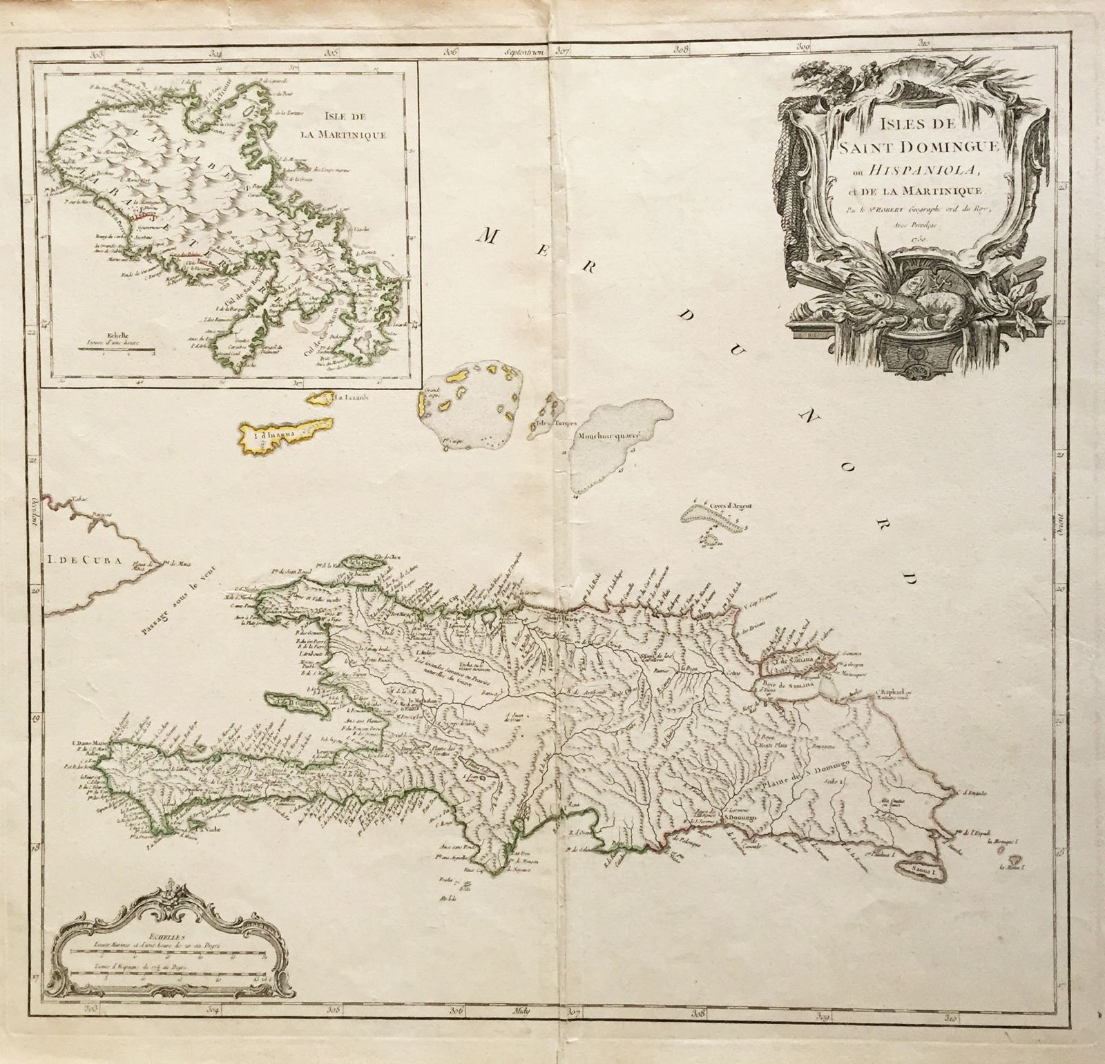
Isles de Saint Domingue ou Hispaniola et de la Martinique.
This item has been sold. Please check our homepage for currently available maps.
The elder Robert's superb map of Santo Domingo island with an inset map of Martinique and a dramatic maritime title cartouche. Item Number: G004
Cartographer: Gilles Robert de Vaugondy
Place & Date: Paris / 1750/1757
Size: 20 1/4" x 19"
Condition: outline color/b&w cartouche. Creases at centerfold; fold repaired at lower margin.
Price: SOLD