
use +/- or mouse scrollwheel for magnification. click here for full-sized image.
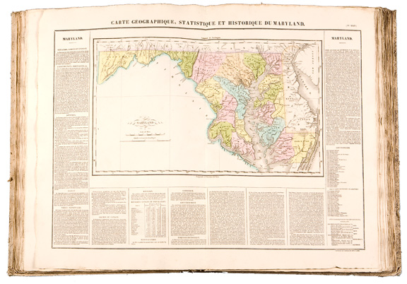
Atlas Geographique, Statistique, Historique, et Cronologique des Deux Ameriques
This item has been sold. Please check our homepage for currently available maps.
A superb exemplar of Buchon's influential Atlas of the Americas, based in part on Carey & Lea's American Atlas of 1822. The beautifully preserved volume comprises 50 of the original 51 maps (Chile, plate LVII, is missing), including maps of the U.S. states and territories in the early 1820s; the provinces, colonies and new nations of North, Central, and South America and the Caribbean; and several continent and special feature maps, charts and tables. The highly detailed and accurate maps are surrounded by text on the geography, history, and economy of the featured region. A gem of early-19th century cartography and atlas-making. Item Number: B1947
Cartographer: Buchon / J. Carez
Place & Date: Paris / 1825
Size: 15" x 21 3/4"
Condition: full color; water stains in the upper corners of the margins on only a few of the plates (XXX through XXXVIII), otherwise the maps are in superb condition. Half-calf cover, worn and scuffed.
Price: SOLD