
use +/- or mouse scrollwheel for magnification. click here for full-sized image.
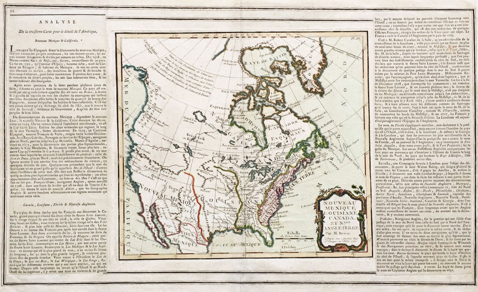
Nouveau Mexique, Louisiane, Canada, et Nlle. Angleterre.
This item has been sold. Please check our homepage for currently available maps.
The highly detailed North America map from Brion de la Tour's Atlas General, Civil, et Ecclesiastique, from Baffin's Bay to Central Mexico. The sketchier mapping of the West Coast is based on Russian sources, published in St. Petersburg in 1754. The map, in delicate outline color, is surrounded on both sides by text on the discovery and history of the French, Spanish, and English territories in North America. Item Number: 400
Cartographer: Brion de la Tour
Place & Date: Paris / 1766
Size: 19" x 11"
Condition: outline color; light overall age toning
Price: SOLD