
use +/- or mouse scrollwheel for magnification. click here for full-sized image.
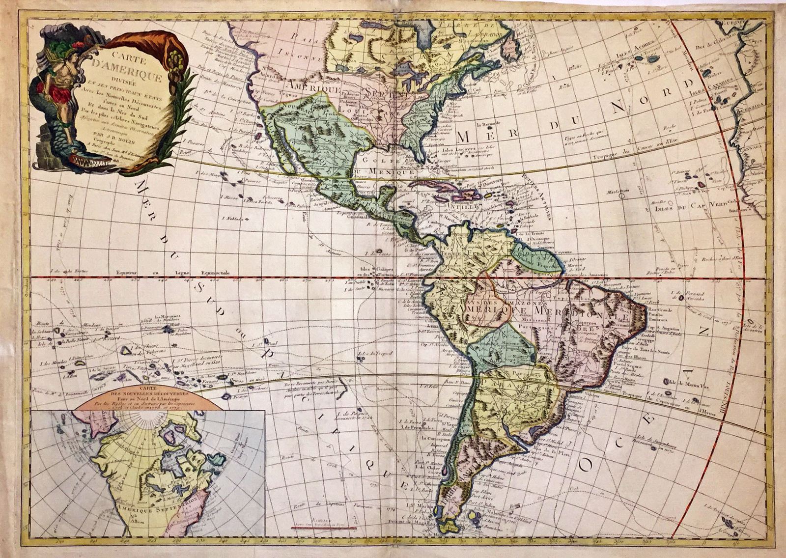
Carte d'Amerique divisee en ses principaux etats.
This item has been sold. Please check our homepage for currently available maps.
A fascinating early 19th century reissue by the French firm of J.B. Nolin of the 1787 Clouet map of the Americas, revised and updated to a degree to take into account the later voyages of captain Cook. The continental outlines and political divisions are still those of the previous century. The British colonies are shown pressed against the Eastern Seaboard by a huge Louisiana Territory, and an enormous Paraguay dominates southern South America. The routes of Cook and many other discoverers are shown in the Atlantic and Pacific. A slightly more up-to-date inset map focuses on northern North America and the explorations of Cook, Clark and the Russians. In this map, a strait exists between Siberia and North America, Greenland is part of the mainland, and the existence of the United States is recognized. The highly decorative title cartouche is also a throwback, featuring America riding a particularly fierce alligator and gazing upon a cornucopia. A rare cartographic curiosity! Item Number: 389
Cartographer: J. B. Nolin
Place & Date: Paris / 1818
Size: 28 1/2" x 20 1/4"
Condition: Wash color; overall age toning; some paper weakness in the margins
Price: SOLD