
use +/- or mouse scrollwheel for magnification. click here for full-sized image.
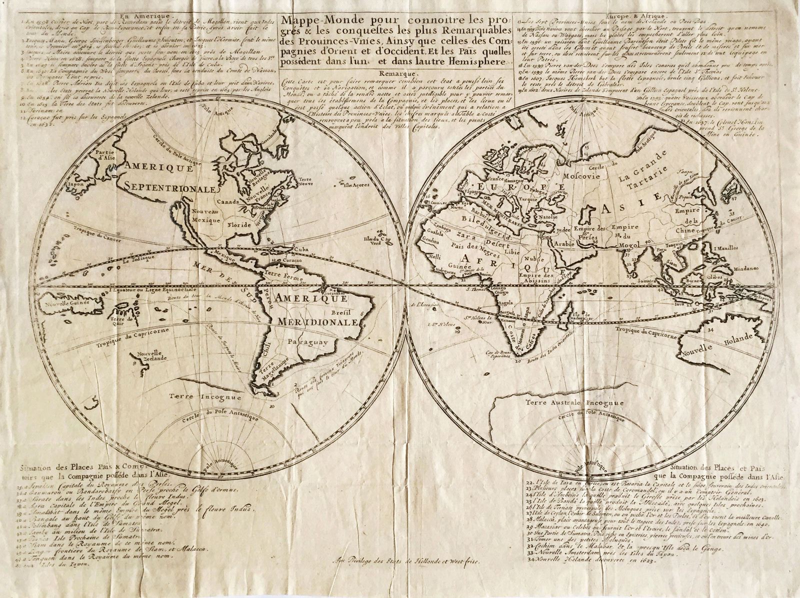
Mappe-Monde pour connoitre les progres & les conquestes les plus Remarquables des Provinces-Unies, Ainsy que celles des Compagnies d'Orient et d'Occident.
This item has been sold. Please check our homepage for currently available maps.
An extremely rare Dutch East India map of the world in two hemispheres showing the tracks of famous circumnavigations and recent discoveries in Australia and New Zealand, whose coastline is only partly outlined. California is shown as an island and Florida extends to the Pacific. The purpose of the map is to show the progress made by Dutch explorers and traders in discovering and establishing outposts in new lands. Surrounding the hemispheres are lists of Dutch possessions in the four continents. Item Number: 338
Cartographer: Dutch East India Company
Place & Date: Amsterdam / 1670
Size: 17 1/2" x 12 3/4"
Condition: b&w; overall age toning; some wrinkling and creasing
Price: SOLD