
use +/- or mouse scrollwheel for magnification. click here for full-sized image.
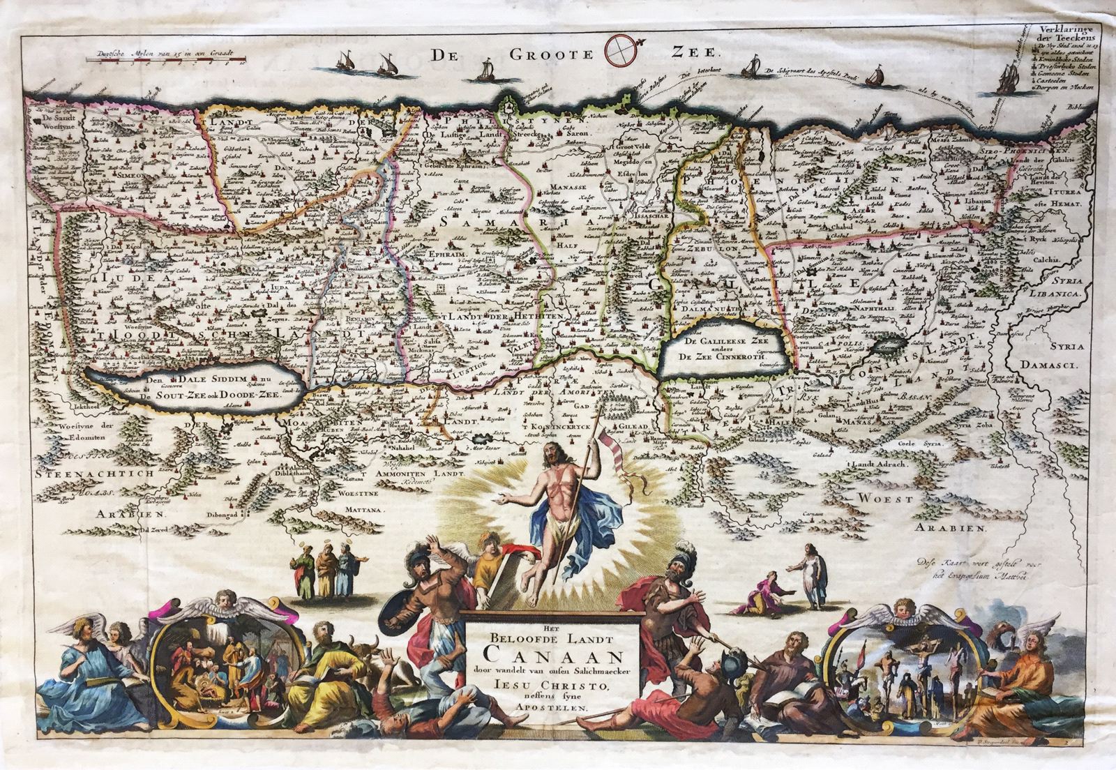
Het Beloofde Landt Canaan.
This item has been sold. Please check our homepage for currently available maps.
A splendid map of "the beloved land of Canaan," oriented with west at the top of the page and featuring a multitude of place names as well as the St. Paul's sea route from Jerusalem to Rome. The Holy Land is divided into both Roman political divisions and Hebrew tribal areas. Beneath the map itself is an extraordinary cartouche with, at the center of the upper tier, the resurrection of Christ flanked by the three Wise Men and Mary Magdalene recognizing the risen Christ; on the lower tier, Evangelists sit on either side of two key New Testament scenes: the Nativity and the Crucifixion. Item Number: 309
Cartographer: D. Stoopendaal
Place & Date: Amsterdam / 1702
Size: 18" x 14"
Condition:
Price: SOLD